Scenic Aerial Photos, and Why State Parks Matter
As a native of New York State and one of seven children living on a college professor’s salary, I spent a lot of time in New York’s state parks and county parks as a child. Because you could drive in for free, parks were a bargain. Fishing from a quiet lakeshore almost guaranteed a bite or a nibble. Nights settled down in warmly-lit cabins, dark inside from timber walls. I became a photographer, I think, because I absorbed so much scenic beauty from an early age.
Now, as an outdoor photographer, I return again and again, taking pictures but also taking trails.
The New York State Park system remains, to me, a refuge, a low-cost option for outdoor therapy. So I worry about cuts to state park funding. My favorite park in the system, Harriman State Park, is today so bereft of improvements or funding that a beach that was destroyed nearly a decade ago still sits unrepaired and locked away.
Last year, I drove across the country in three weeks. Every day ended in a state park; I slept in their campsites along the way. My daily exercise consisted of a morning hike, then an afternoon jog. State parks delivered, in state after state.
I think our country’s national parks get all the glory. Doubtless, they hold the highest honors for scenic vistas, photographable travel destinations.
But for my money, the state parks do the heavy lifting. Spending the night in a state park remains the country’s biggest bargain (after postage stamps). The parks draw people to smaller towns and places along the road that highways bypass. Some — the linear parks like the Old Croton Aqueduct — link small towns to others. The parks earn their keep, and then some.
Aerials For Scenic Context
This week, I spent some time on collecting aerial images near the Delaware Water Gap, along the Old Croton Aqueduct Trail, and in a Westchester County Park called Oscawana.
While I use aerial photography for different purposes, its appeal lies generally in the ability to capture context of a place. Because the aerial viewpoint reveals more about wider surroundings, I can show not just a bridge, but the water, trees and hills, wide sky beyond.
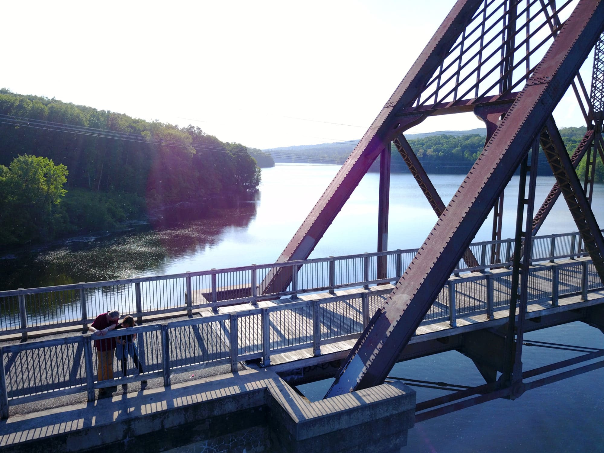
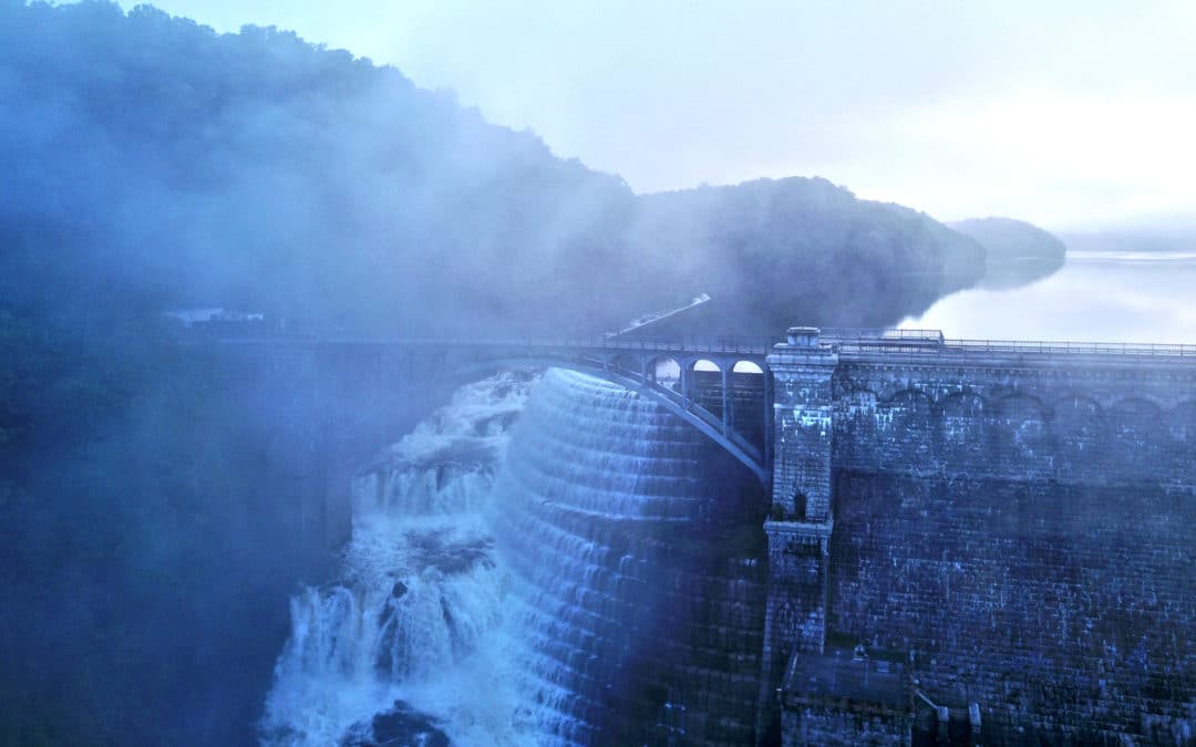
Stopping on the old railway bridge across the Croton Dam, in the Westchester County. The bridge is part of the scenic Old Croton Aqueduct, a New York State (linear) park along a former aqueduct. Aerial images don’t have to be from a lofty vantage point! Sometimes I’ll use a drone to just get a different angle, or find a view that gives more context, a sense of the wider location. If you’re building a photo library for your park, town, or destination, aerials are a must.
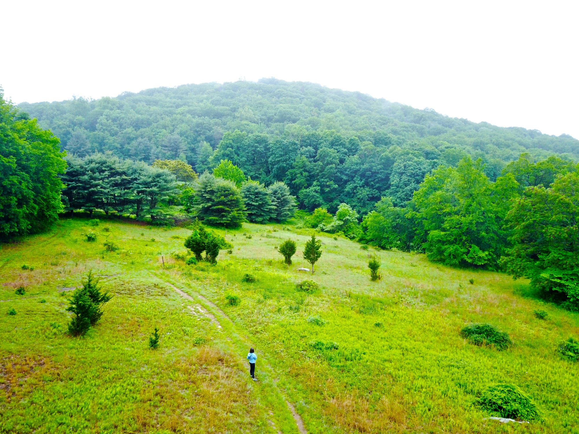
A hiker (me!) on Bald Mountain, part of the John E. Hand Park in Yorktown Heights, New York. The Teatown-Kitchawan trail cuts through the park, connecting Teatown to the reservoir.
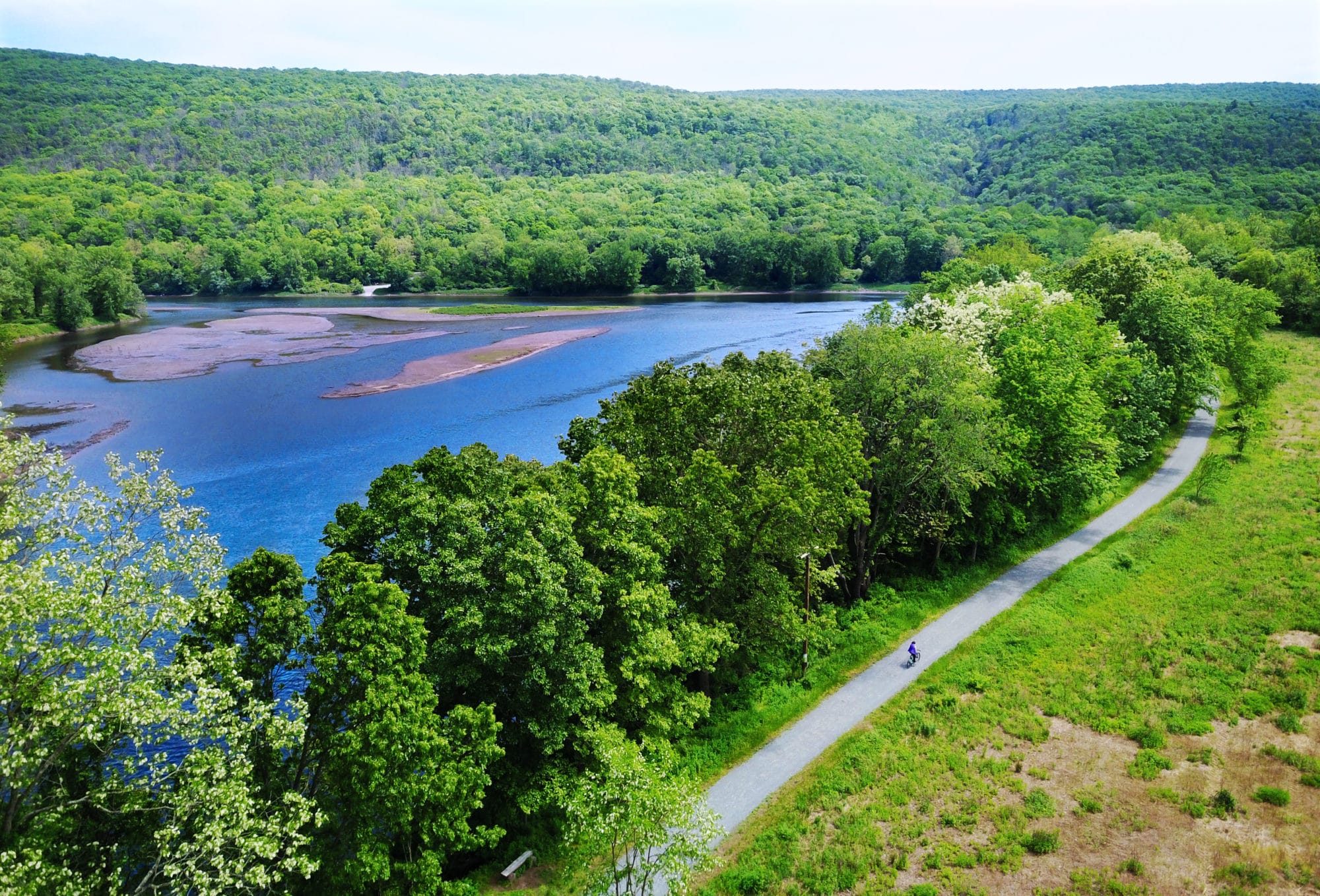
The McDade Recreation Trail, a bike path in the Delaware Water Gap on the New Jersey/Pennsylvania border. The trail extends most the length of the DWG, with views of the river, open farm fields, forests, and historic landscapes. Most trailheads are along the park’s free bus route that operates summer weekends.
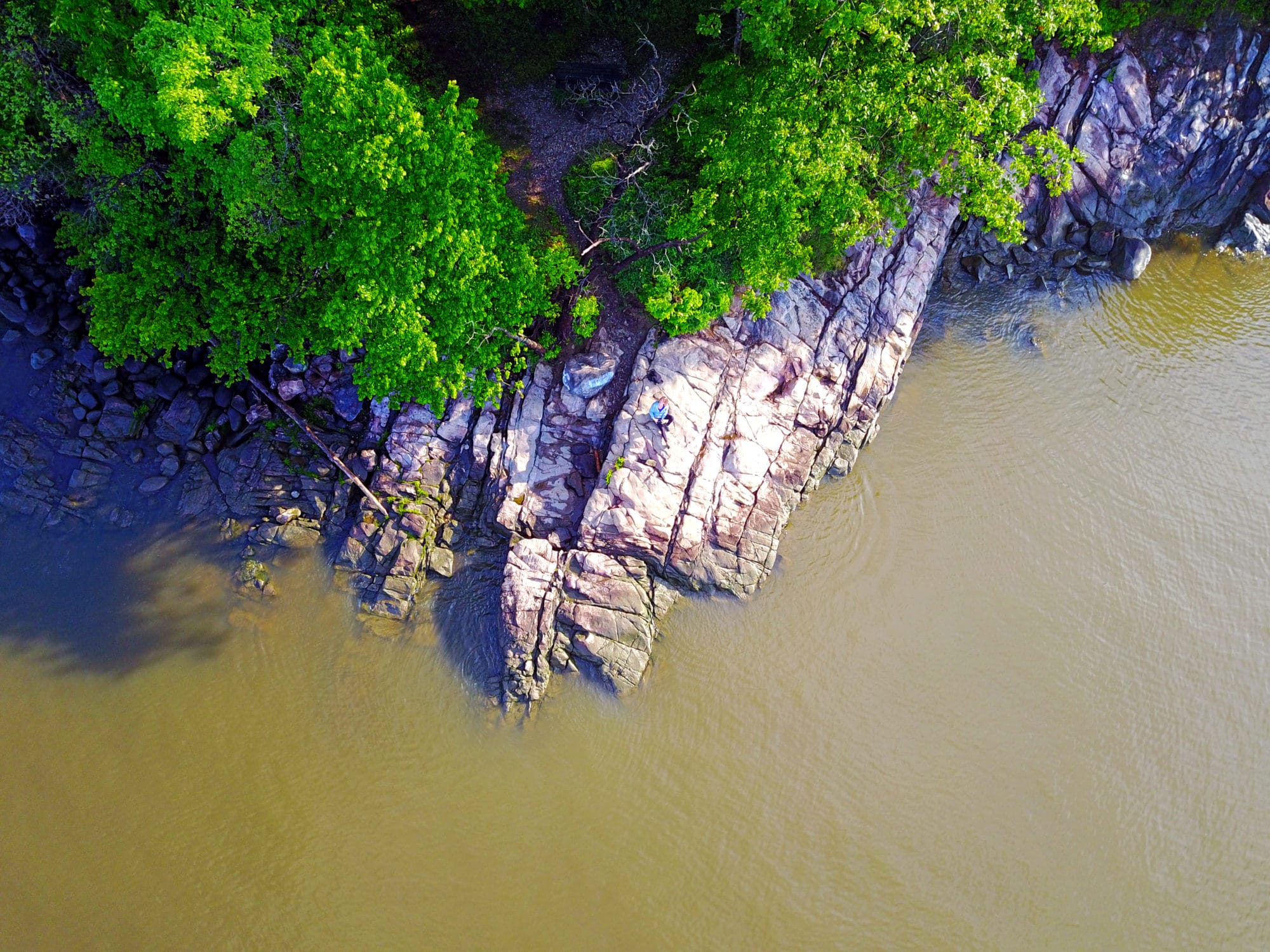
A rocky promontory into the Hudson River at Oscawana Park, in Westchester County, New York. While brown during the day, evening turns the river a deep blue, as it returns the darkening light back up to the sky.